


Find out more: https://community.oracle.com/products/oracleanalytics/categories/training
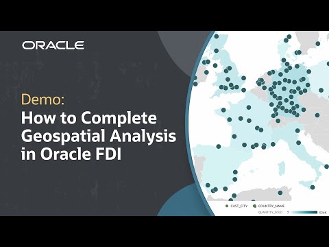
In this tutorial, we’ll learn how to perform a geospatial analysis in Oracle Fusion Data Intelligence (FDI), a part of Analytics Cloud. Geospatial analysis helps business users visualize data by location as a way to discover regional patterns, trends relationships, and correlations. This tutorial reviews all of the steps for selecting data points tied to real-world locations, selecting the map visualization, and layering the data points for deeper analysis.
Like what you learned about Oracle Fusion Data Intelligence? Subscribe now https://social.ora.cl/60025k87j
Join us at Oracle CloudWorld – https://social.ora.cl/60035eVvJ
Contact FDI Sales – https://social.ora.cl/6003FLUMT
Learn More about Oracle FDI – https://social.ora.cl/6009FLU33
FDI Customer Success Stories – https://social.ora.cl/6002FLU3Q
Follow us here:
LinkedIn: https://social.ora.cl/60035eXuF
X: https://social.ora.cl/6008abVgG
Instagram: https://social.ora.cl/60095eXDN
Facebook: https://social.ora.cl/60065enQp